THERESA HITCHENS

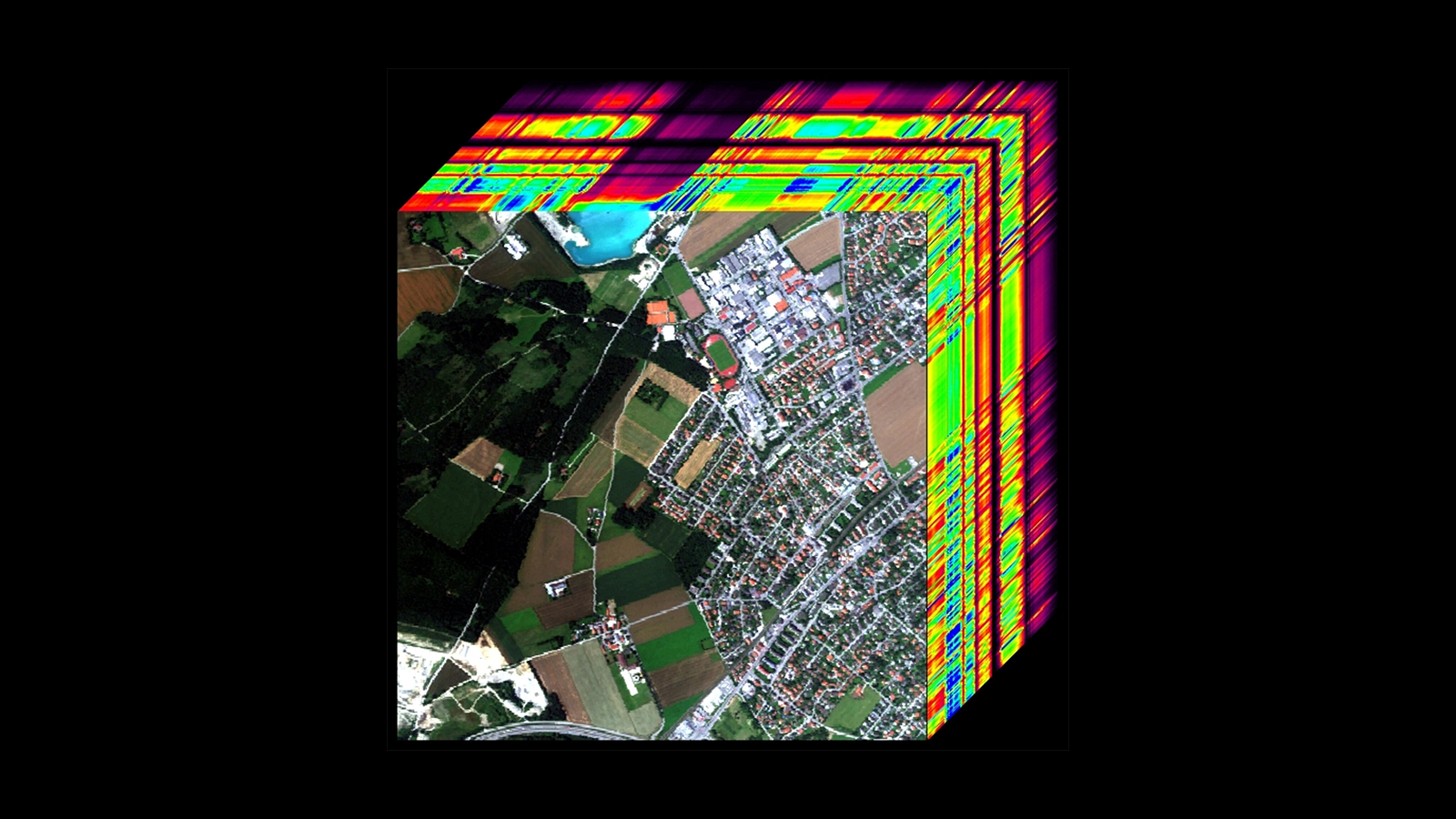
WASHINGTON — The National Reconnaissance Office has released its formal request for proposals from commercial operators who can provide the spy satellite agency with hyperspectral imagery, which can pinpoint things like buried landmines and surface areas that have been camouflaged.
“We’re looking forward to seeing what is available,” NRO Director Chris Scolese told a gathering of the Intelligence and National Security Alliance (INSA) on Tuesday evening. “We see that in the next set of phenomenology, we really want to go after.”
He said on Tuesday that the agency released its long-awaited RFP to industry under its Broad Agency Announcement (BAA) Framework for Strategic Commercial Enhancements — an umbrella tool that covers acquisition of new and emerging phenomenologies. The BAA has been used over the past two years to gather commercially-provided electro-optical, synthetic aperture radar (SAR), and radio frequency remote sensing data.
The NRO does not release details of its RFPs in public, even unclassified ones, but interested vendors can obtain the information via the agency’s Acquisition Research Center (ARC) website.
Hyperspectral cameras break down pixels into hundreds of frequency bands and thus can detect minute differences in colors that cannot be seen by the human eye, or detected by other types of imagery cameras such as infrared. Thus, hyperspectral sensors can “see” what materials a surface is made of and identify individual elements in the surrounding atmosphere. Such cameras have been used for three decades on airborne platforms for things like analyzing crop health, but until recently have been too expensive for use on satellites.
Hyperspectral imagery could allow analysts at NRO’s sister agency, the National Geospatial Intelligence Agency (NGA), to do things like identify drug production facilities or find evidence of chemical weapons production.
NGA is responsible gathering up, analyzing and then disseminating imagery products — for example, from static maps showing Chinese nuclear research facilities to daily pictures of Russian troop movements in Ukraine — from all kinds of sensors (not just space-based) to government users, including military commanders.
The work can involve contracting with commercial satellite imagery firms for analytical products and software capabilities to help imagery analysts speed through piles of raw data — a mission NGA retained when responsibility for acquiring commercial imagery itself was hived off to NRO in 2018. Since that time, NRO often has been following behind NGA in contracting with commercial firms for emerging satellite-based capabilities such as RF geolocation. With the hyperspecral imagery RFP, however, NRO is actually out in front of NGA.
Scolese told the INSA audience that his agency is dedicated to leveraging as much commercial imagery as possible.
“The main thing is commercial’s doing a lot of stuff we want to take advantage of. And we’ll evaluate each and every one of them,” he said.

No comments:
Post a Comment