Judd C. Kinzley
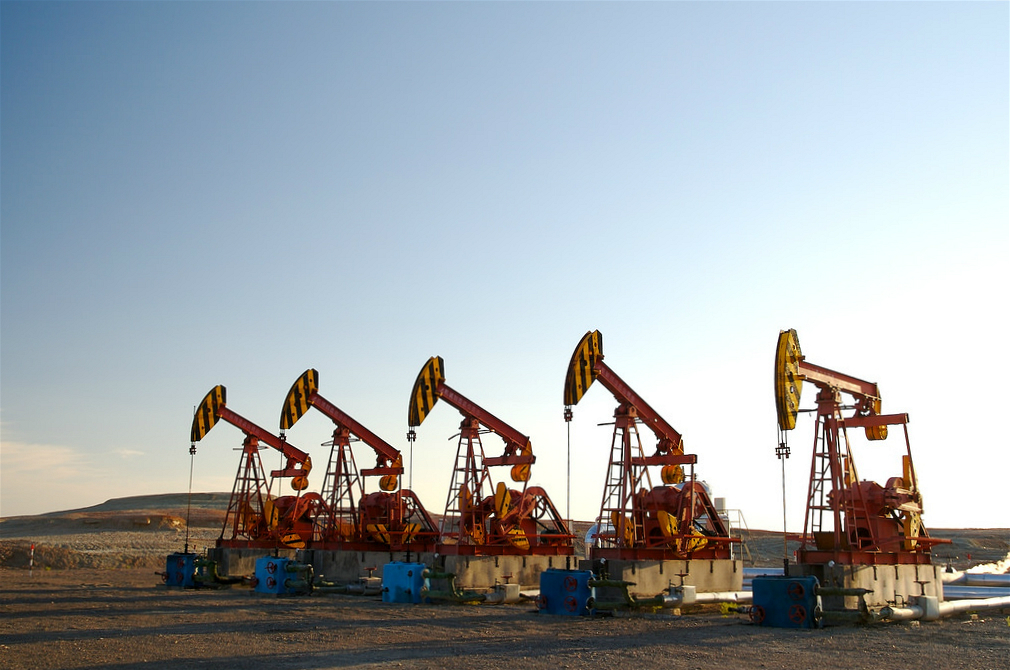
 At Baijiantan in northern Xinjiang’s Zungharian oil field, oil derricks as far as the eye can see silently plumb the earth for every last drop of crude. By contrast, there are several well-known oil sites outside of the city of Kashgar in Xinjiang’s far south, where sticky black crude oozes and bubbles out of the ground untouched, collecting in dark, viscous pools.
What separates Baijiantan from sites in the south is not the presence or lack of petroleum. Rather, the patterns of extraction that have shaped Xinjiang’s landscape stem from choices made by a series of past regimes.
It was an open secret in the nineteenth century that in some places in Xinjiang, raw crude pure enough to light lanterns and stoves could be collected by the bucketful. Geographical surveys stretching back to the Qing period (1644-1911) identified oil seepages throughout the region. As well as the arid steppe land of the Zungharian basin, they also pointed to several sites in southern Xinjiang, in the Tianshan mountain range and in the far eastern stretches of the province. These observations were confirmed by British and Russian agents eager to catalogue the region’s rich resource wealth in the waning years of the Qing.
However, a succession of regimes from the Qing and on into the early People’s Republic lacked the capital to construct the drilling rigs, refineries and transport networks needed to extract, process and move petroleum in this border region, located 2,000 miles from Beijing. Without this critical infrastructure, Xinjiang’s black gold was little more than a trickle of sticky black liquid, or a footnote in a geological report. With limited resources, Chinese officials were forced to make difficult choices about where to spend their money. The consequences remain inscribed onto Xinjiang’s landscape today.
The shape of history
In contrast, officials in the Russian Empire and after 1917 the Soviet Union actively pursued the area’s petroleum. Russian and Soviet geologists conducted comprehensive surveys of Xinjiang’s resource wealth and identified several oil fields scattered throughout the vast region. But the development of a Central Asian transport network, and in particular the completion in 1929 of the Turkestan-Siberian rail line that ran parallel to Xinjiang’s northern border, helped concentrate their interests around a small handful of sites located in northern Xinjiang, not far from international border crossings.
In 1934, Soviet agents signed a series of agreements to provide large loans to cash-strapped provincial officials in exchange for privileged access to the region’s resource wealth. Following in the footsteps of their predecessors, Soviet geologists and planners focused their efforts on northern Xinjiang.
Soviet economic planners prioritised one oil field in particular, at a place called Dushanzi, located in the heart of the Zungharian basin in northern Xinjiang. By 1939, Dushanzi boasted drilling rigs, a high-tech refinery and a broad network of pipelines and roads that bound the site to the provincial road network, border crossings and transport hubs on the Turkestan-Siberian rail line.
In 1942, fearing the Soviet Union’s imminent collapse, Xinjiang’s provincial governor Sheng Shicai abruptly cancelled the Soviet agreements and instead sought to strengthen connections to the Republic of China. For their part, officials in China’s wartime capital of Chongqing were eager to gain access to Xinjiang’s resources and were particularly interested in acquiring the petroleum needed to fuel their war effort against Japan. They immediately began drawing up ambitious schemes to expand Xinjiang’s resource map and redirect its petroleum wealth east. These plans were derailed, however, by lack of funds.
Eager for oil but skittish about the high costs, Chinese officials followed Xinjiang’s roads back to Dushanzi and the Soviet oil fields in northern Xinjiang’s Zungharian basin. Even after efforts to establish a joint Sino-Soviet oil extraction operation based in Dushanzi collapsed in 1943, Chinese officials worked from Soviet geological plans, made use of Soviet-funded roads and relied on production from Soviet-dug wells.
Following in Soviet footsteps
The patterns of extraction established by Soviet planners, which focused on investing in northern Xinjiang at the expense of the south, would continue after the collapse of the Republic of China and the establishment of the People’s Republic in 1949.
Even the comparatively small amounts of money allocated for drilling in southern Xinjiang were pulled in 1953, in favour of consolidating the proven oil field in northern Xinjiang. That year, a Central Committee resolution decreed that oil operations in Xinjiang should be concentrated in the north. The document further insisted that “production should be restricted to areas with existing [refining] equipment,” which in this case simply meant Dushanzi.
Throughout the Mao period and into the post-1978 reform era, the larger contours of oil extraction continued to be framed by the capital investments made in northern Xinjiang in the 1930s. Only since the 1990s, when Chinese domestic petroleum demand spiked, has oil production in the region inched south. Even still, the refinery at Dushanzi, first built in 1939 with rubles and assistance from Soviet technicians, remains a key hub in China’s petroleum industry in the northwest of the country. The pipelines that spiderweb out from Dushanzi, as well as other processing facilities in Karamay, Kuqa and Urumqi, have established a vast petroleum-soaked corridor that stretches from the southern foothills of the Tianshan to the northernmost stretches of the Zungharian oil field at Baijiantan.
This history of oil extraction has had a powerful impact on Xinjiang, shaping patterns of state investment, migration and socio-economic inequalities. It has shaped the environment of the major oil producing centres in northern Xinjiang. And it has been a major contribution to the north-south divide in the region.
No comments:
Post a Comment